Langtang Valley Trek Update 2026: Is It Safe After the Flooding?
What Happened on 26 August 2026
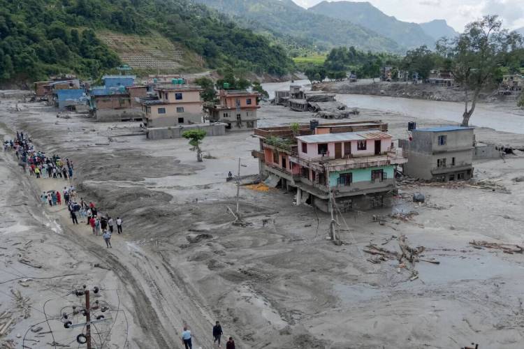
On the morning of August 26, 2026, a massive glacier collapsed from the north flank of Langtang Lirung (around 5,200 m), triggering a catastrophic flash flood. The flash flood raced down the Lhende Khola (river) into the Bhote Koshi and Trishuli River corridors. Unlike the 2015 earthquake-triggered avalanche, this was a glacial collapse that created flash flooding down the Trishuli River, devastating dozens of settlements in both Nepal and neighboring Tibet.
Within minutes, it completely destroyed the Nepal-Tibet border infrastructure at Rasuwagadhi. It tore through the village of Timure, Syabrubesi, Betrawati, and many other settlements. It was more of a Nepal tsunami where the human toll remaining more than 1,500 confirmed dead and thousands still missing across Nepal and Tibet.
The most tragic is that the roads, bridges, hydropower plants, and entire riverside human settlements were erased.
Why the Main Langtang Trail Was Not Destroyed
Here is the crucial geographic fact that most headlines miss
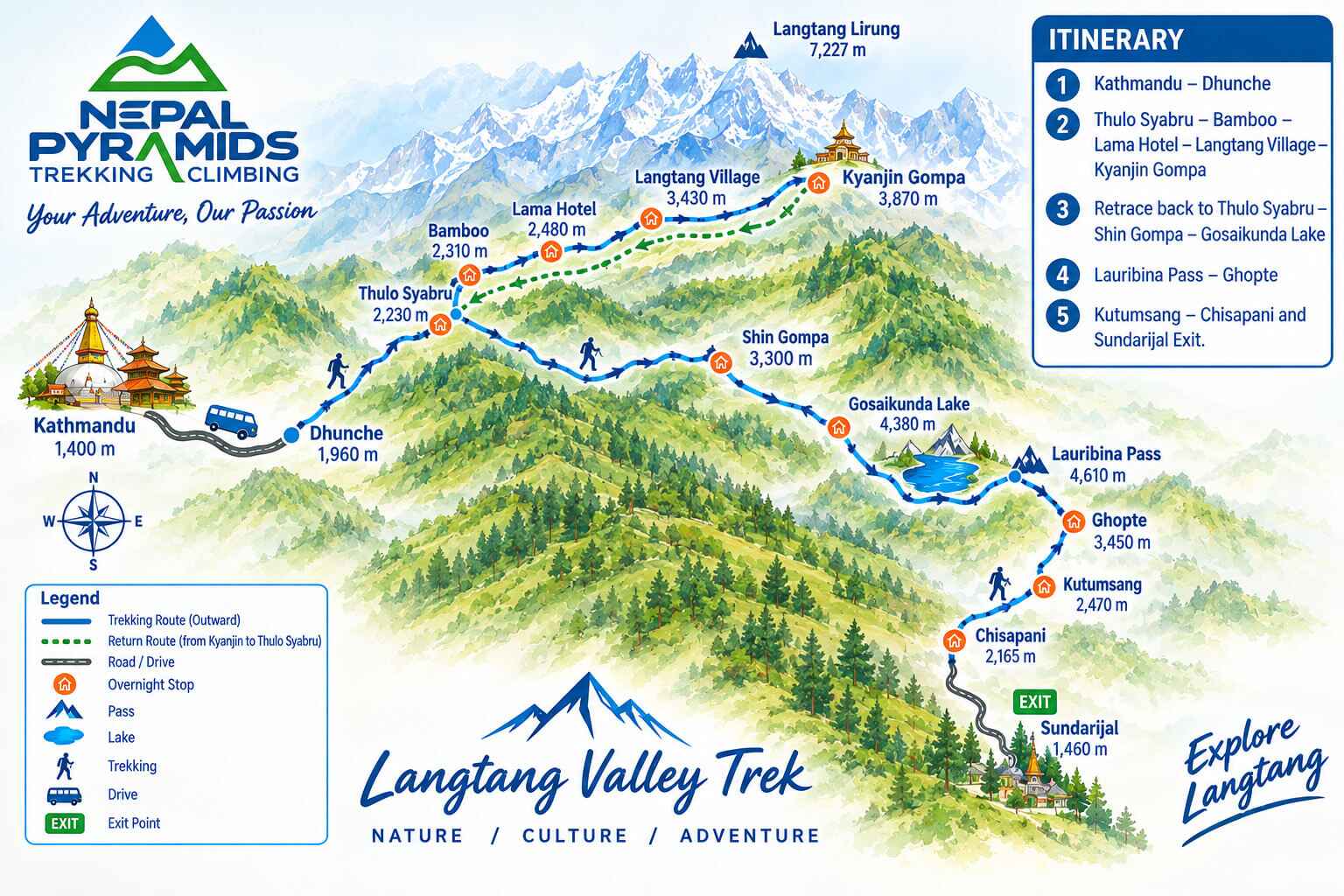
The main Langtang Valley trekking trail itself was not affected by this devastating flash floods. The world needs to know that the classic Langtang Trekking route follows the Langtang Khola, and it is a separate gorge that meets the Bhote Koshi only at Syabrubesi. The upper valley, like the Dhunche, Thulo Syabru, Lama Hotel, Ghoda Tabela, Langtang village, Kyanjin Gompa, or Gosaikunda Lake route, sits in a different terrain and valley and is still very functional.
What the flood destroyed
The flash flood has destroyed roughly 19 bridges and about 40 kilometres of Pasang Lhamu Highway along the Bhote Koshi - Trishuli corridor. The worst-hit areas are the Rasuwagadi Border Crossing (between Nepal and Tibet/China), the Timure Village (Langtang Heritage Trail), and Syabrubesi (the traditional starting point of the Langtang Valley Trek).
IMPORTANT NOTE: This event was localized to Rasuwa district. Everest Base Camp, Annapurna, Manaslu, Upper Mustang, and every other trekking route outside Rasuwa are not affected and are running as normal. Only the Langtang Valley Trek, the Tamang Heritage Trail, and the Gosaikunda Trek are affected due to the destruction of road infrastructure.
The Kerung border crossing for Kailash Mansarovar is completely closed and will surely take a while to reopen.
As of 21 September 2026, the road from Kathmandu through Trisuli Bazaar - Betrawati - Dhunche remains closed for recovery, and it is in an 'opening soon' process. Syabrubesi is the most severely flood-affected settlement, so it is heavily restricted.
Road Update
The Trishuli Bazaar - Betrawati - Dhunche road is steadily coming back to life. Nepal Government has been working section by section to clear debris, rebuild washed-out stretches, and install temporary bridges. Progress has been genuinely encouraging. Several kilometres are already passable, and the remaining gaps are expected to be made accessible by mid October.
We are tracking the situation closely and will update this post as soon as the full route reopens to regular traffic.